Bringing up the interstate highway system of New York City is nigh near impossible without mentioning the name “Robert Moses”. Lauded by admirers as an architectural visionary and derided by critics as an egomaniac who was intent on wrecking neighborhoods, one cannot argue that Moses left his mark in big ways in the Big Apple, and would have left an even bigger mark were it not for the determined efforts of his opponents.
Moses, who was born in New Haven, Connecticut in 1888, eventually moved to NYC after graduating from college. Gradually he rose in power and stature in the city, despite never being elected to public office. He was instrumental in massive infrastructure projects during the New Deal of the 1930s, including what would become the city’s sprawling bridge and freeway system.
Moses, who took a remarkably unsentimental view of the past while constantly focused on the future, once remarked: “You can draw any kind of picture you want on a clean slate and indulge your every whim in the wilderness in laying out a New Delhi, Canberra, or Brasilia, but when you operate in an overbuilt metropolis, you have to hack your way with a meat ax.” And hack away he did, or at least tried to. One of his projects that earned him a great deal of notoriety was the planned Lower Manhattan expressway.
The extremely talented Andrew Lynch has made some wonderful adaptations from Google Maps on his website http://www.vanshnookenraggen.com of what the unbuilt Lower Manhattan freeway would have looked like:
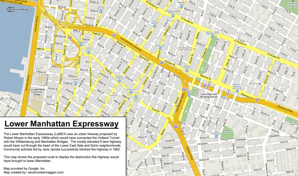
Essentially the Lower Manhattan would have formed a three-way connection (meeting up with an extended Interstate 478 to the immediate west of Sara D. Roosevelt park) between the Holland Tunnel, the Brooklyn Bridge, and the Williamsburg Bridge, slicing through the Lower East Side and potentially leaving a good portion of Broome and Delancey Streets in its shadow. Untappedcities.com provides the artist’s rendering for the highway:

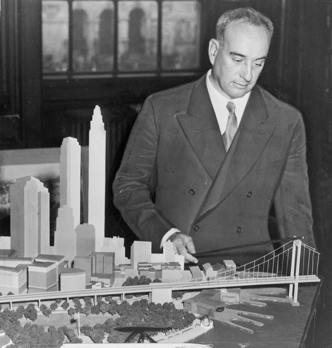
If this wasn’t daring enough, Moses also had plans for another freeway to cross the Midtown district:

The goal of the Mid-Manhattan expressway was to link the Lincoln Tunnel to New Jersey with the Queens-Midtown Tunnel to the eastern boroughs. Coming from the west, the highway was to travel parallel with West 39th Street, turn south between 9th and 10th avenues, continue east between 29th and 30th, and then turn north again before reaching the tunnel to Queens.
An artist’s rendering model of the mid-Manhattan. Note the Empire State Building on the right and the proposed Madison Square Garden in the background:

Needless to say, there were many buildings and other historical markers standing in the way of these projects. Speaking on Moses’s plans for Lower Manattan, Anthony Paletta, in writing for the Guardian:
The Lower Manhattan Expressway was an effort to tie up the loose ends of local roadways by extending Interstate 78 – all 10 lanes of it – from the Holland Tunnel to the Manhattan and Williamsburg Bridges. The obstacle was the streetscape of SoHo and Little Italy, and the great variety of uses within that the city found dispensable.
“The grand total for proposed demolition was 416 buildings that housed 2,200 families, 365 retail stores, and 480 other commercial establishments,” wrote Anthony Flint in Wrestling with Moses.
Moses eventually met his match in prominent neighborhood activist Jane Jacobs, and the two freeways that would have rolled through Manhattan were eventually removed from the city’s highway planning. It would have been interesting, however, to see how the character of Manhattan might have been changed if Robert Moses had had his way.
