The twin cities of Minneapolis and St. Paul, Minnesota have enough examples of canceled and altered highway projects that it would be enough to merit a whole series in its own right. Yet one in particular stands out: the anomaly known as Ayd Mill Road in St. Paul, which meanders through the west-central part of the city, from Selby Avenue near Concordia University to its southern terminus at I-35E near Jefferson Avenue. One might ask if Ayd Mill is a standard road, a parkway, or a freeway? The correct answer might be that it’s a little of all of these, and the debate rages on over what it should be for the future.

Traveling east on Selby Ave. in St. Paul, one is greeted by the northern end of Ayd Mill with an on-ramp and a small sign at the split-off. Easy to miss if you’re not really paying attention to your surroundings:

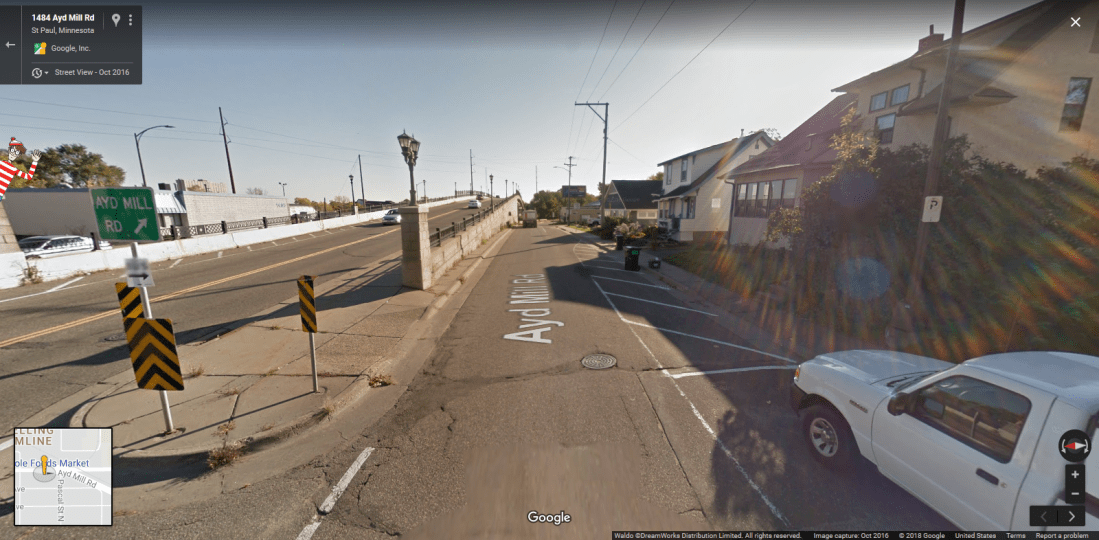
From there Ayd Mill travels at ground level through several St. Paul neighborhoods. The speed limit on the highway is 45mph. What’s unusual about this road is the weird mixture of off-ramps and stoplights that juxtapose its various intersections.

Ayd Mill near Hamline Avenue. Southbound traffic exits to Hamline via the off-ramp, while northbound traffic waits at the stoplight to turn.

Traveling southbound, near the southern terminus. Right lane exits off to Jefferson Avenue, with left lanes eventually merging onto I-35E southbound.
So what is the history behind Ayd Mill Road? In the 1880s, Ayd Mill was originally a stream bed before Chicago, Milwaukee, St. Paul and Pacific Railroad bought up the right-of-way. Commuter trains used the route to ferry passengers back and forth between St. Paul Union Depot and the Milwaukee Road Depot in St. Paul’s twin city of Minneapolis.
After the railway fell into disuse, the city of St. Paul began construction on the Short Line Road (the original name of Ayd Mill) in the 1960s in an attempt to link I-35E with I-94. The route was to allow easy travel from commuters in the south suburbs of St. Paul to reach Minneapolis without having to go through downtown St. Paul. However, opposition to the proposed plan in the Summit Hill and Merriam Park neighborhoods kept this dream from becoming a reality. It wasn’t until 2004 that Ayd Mill was extended south to make a connection to I-35E. To this day, Ayd Mill continues to generate discussion and arguments in the Twin Cities. Should the road be extended further north to link to I-94? Should it be upgraded to a full expressway? Should it be converted to a “linear park” with fuller access for bicycles and pedestrians? The debate continues….
Other sources:
http://www.steve-riner.com/mnhighways/other_rtes.htm

Our stater, i take short line from I-35E to Snelling Ave. To Minnesota State Fair and Axman Surpluses on University. It was a nice road till they add the Stop sign and Signal lights and took away the easy off at the north end of it to the Street level.
LikeLike
Thanks for that additional bit of history, Douglas. I wasn’t aware of that!
LikeLike
My friends and I used to play in the roadbed near Hamline while Short Line was being built. We also played ball in the area between what was then Short Line Road and Hamline Ave. after the road was built. We also would sled down the hill/embankment next to the Hamline Ave. bridge in the winter while it was under construction.
LikeLike