Travelling back up I-71 through Cleveland, and then along Lake Erie on I-90, we arrive on the eastern end of the “Rust Belt” of the United States: snowy Buffalo, New York. Of course, native Buffalonians are likely tired of hearing the only associations with their city being “snow” and “Rust Belt”. Aren’t there more positive things we can say about their city? There sure are! Buffalo actually has a rich history of achievements among the major U.S. cities: it is home to one of the first skyscrapers built in the world, the Guaranty Building. In 1886 it became the first U.S. city with electrically-lit streets. After Chicago, Buffalo is the city with the most houses built by architect Frank Lloyd Wright. Buffalo is also the hometown of five professional sports teams and two U.S. presidents. The city is also renowned for its extensive city park system and lively arts scene. Many other interesting facts about Buffalo can be found here.
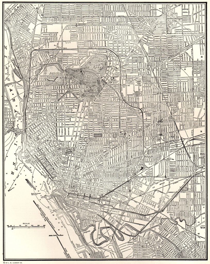
Buffalo’s road network also makes it unique from other cities: it is only one of three major U.S. cities (the others being Washington, D.C. and Boston, Massachusetts) with a “radial grid” street pattern, consisting of arterial roads branching out in many directions from its downtown area.
According to Steve Cichon at BuffaloStories.org, Buffalo was considered to be “late out of the gate” compared to other major U.S. cities in its post-World War II highway planning, and so city planners were determined to make up for lost time by “pushing hard” and “pushing fast” to get construction of its expressway network underway. This did not sit well with some Buffalo residents. While some Buffalonians pressed for the necessity of connecting the downtown with Niagara Falls, the airport, and outlying suburban areas, other natives were far less enthusiastic, especially those who stood in the path of the wrecking ball in the city’s high-density inner neighborhoods.
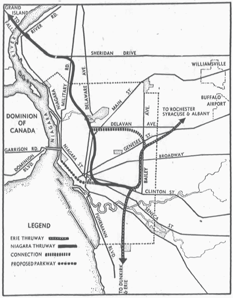
The 1946 plan for Buffalo was fairly simple. The proposal consisted of the Erie and Niagara Thruways (later I-90 and I-190, respectively) with some alterations from their current routing. Two connector highways were proposed, one linking the Erie and Niagara Thruways with a route that ran alongside Delavan and Bailey Avenues, and the other connecting the Niagara with the Peace Bridge to Canada.
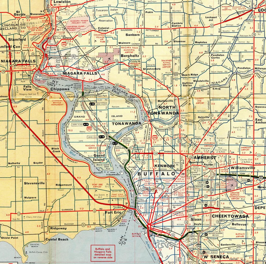
Of course, many changes were made in the following years, and by the early 1960s the planned expressway system already began to resemble what Buffalonians would recognize today:
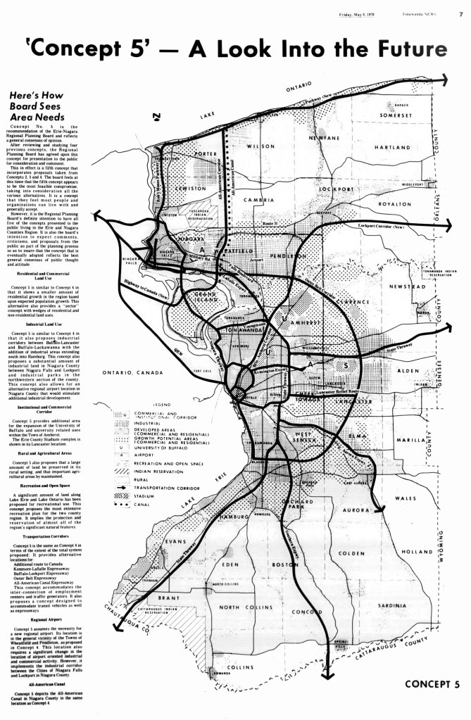
Of course, this doesn’t tell the whole story. Throughout the 1950s and 1960s, plans were already being considered to make Buffalo’s freeway system bigger, and in some cases, much bigger. By 1970, city planners in Buffalo drew up a regional transportation plan known as “Concept 5”, which, in retrospect, proved to be highly ambitious for the time. Right before the U.S. manufacturing sector took a major hit during the 1970s, local officials in Buffalo were anticipating a substantial boom in population for the metropolitan area, which would necessitate a major expansion in the metro area’s highway network. In much the same way as its city streets had been built, the plan for this revised “Concept 5” expressway system also (loosely) followed a radial grid pattern, with several concentric “loop expressways” connected by arterials spreading across the region in multiple directions.
Some of these mapped expressways were never built. Others were built years later, some to more completion than others, as you can see from this metro area map, circa 2015:

While there isn’t enough time to go into great detail on all of these projects, here are some of the more notable and controversial ones:
I-190:
While the actual construction of I-190 itself was never “canceled”, one other important aspect of the highway was. For many years, I-190 had the unique distinction of being something unusual among American highways: an urban interstate that was also a toll road. Most major cities in the United States have toll roads that go around or bypass major cities: think I-294 in Chicago or the newer Sam Houston Toll Road in Houston, Texas.
I-190, however, charges straight into the city of Buffalo from its northern terminus at the Canadian border before re-uniting with I-90 south of the city, with some picturesque views of the Buffalo skyline and the Niagara River along the way. Some Buffalonians have been critical of the current routing of the interstate, pointing out that the highway cuts off the downtown from the waterfront, a criticism we’ve seen already play out in other cities.
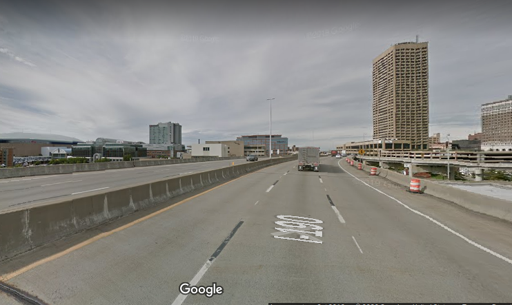
Northbound on I-190, near downtown Buffalo.
For over 40 years, I-190 was originally considered part of the New York State Thruway system. Originally the plan was for I-190 to become completely toll-free in 1996, after the bonds for the construction of the expressway had been paid off — but the tolls continued to be collected for another ten years afterwards. Eventually, 20,000 residents in the metro area banded together to sign a petition to do away with the collection of tolls altogether, pointing out that I-190 was the only interstate in upstate New York to levy tolls on local commuters. In late 2006, the collection of tolls ceased, along with the removal of the ubiquitous “blue hut” toll booths. Interestingly enough, the toll booths became a sought-after item in aftermarket sales after their removal.

One of the old I-190 Toll Booths
Scajaquada Creek Expressway (State Route 198):
The Scajaquada (prounounced “Ska-JACK-quah-duh”) forms the northern part of Buffalo’s “inner belt” freeway. A series of serious accidents in recent years led to the state government lowering the speed limit along the expressway from 55 mph to 30 mph in 2015. At issue is the fact that the Scajaquada curves in many places as it travels through urban park areas, oftentimes without substantial guardrails and/or concrete barriers, thus posing dangers to pedestrians, cyclists, and motorists alike. While some motorists routinely disregard the lowered speed limit, other Buffalonians have called for de-commissioning the expressway entirely, pointing out that the highway cuts Delaware Park in half.

Along the Scajaquada Expressway in Delaware Park
Kensington Expressway (aka “The 33”):
The Kensington forms the southern part of the “inner belt” freeway, although it doesn’t quite “close the loop” with I-190 at its southern terminus, ending instead in the middle of downtown Buffalo.

At the southern terminus of the Kensington expressway, near Elm and Tupper Streets.
For years, there were at least two proposals considered to connect the Kensington to I-190. One would have been at I-190’s Exit 8 interchange (Niagara St./State Route 266), although an equally likely candidate would have been the Exit 6 interchange (Canalside/Elm St.), which would explain the long extended entrance/exit ramps from I-190.
The Kensington also saw its share of controversies in its construction, having cut through Buffalo’s historical working-class “ethnic” neighborhoods and decimating the original tree-lined Humboldt Parkway. Along with the Scajaquada, calls have been made to remove and decommission the Kensington as well.
LaSalle Expressway:
The LaSalle is a 2 1/2 mile expressway that connects I-190 to Williams Road (SR 265 & SR 384) in the Niagara Falls area. Curiously, the LaSalle was never assigned an Interstate, U.S. Highway, or State Route number, and thus remains unnumbered. It originally was planned to extend further east as part of the “outer belt” Belt Expressway and further west to the Rainbow Bridge.
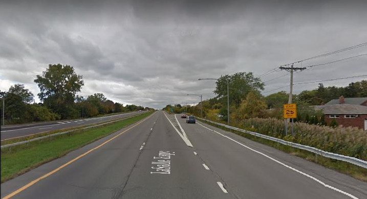
The LaSalle Expressway in the Niagara Falls area
Mile Strip Expressway:
The part of State Route 179 south of Buffalo between State Route 5 and U.S. Highway 62. At just over a mile in length, it is the only other part of the “outer belt” freeway that was completed during the 1960s.

Westbound on the Mile Strip, near State Route 5.
Niagara Scenic Parkway:
Originally known as the Robert Moses State Parkway until 2016. Plans were discussed in the late 1950s for a limited-access highway connecting the Rainbow Bridge in downtown Niagara Falls and heading north, eventually reaching the Lake Ontario State Parkway. The portion that ran through Niagara Falls State Park was largely removed during the 1980s, thus splitting the highway into two segments and rendering it discontinuous. Additional downgrading of segments of the parkway have continued in the years since. In early 2019, an additional segment was removed from Main Street (State Route 104) up to Findlay Drive, and to be replaced with pedestrian and bicycle paths. Will the rest of the parkway be downgraded or removed? It remains to be seen…
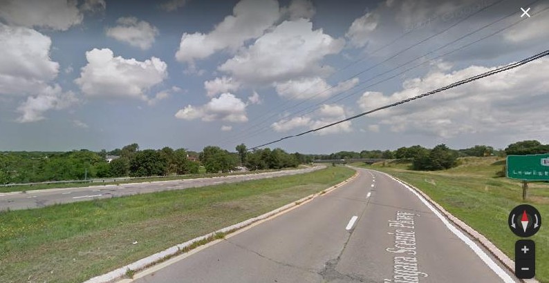
Northbound on the Niagara Scenic Parkway, near Lewiston.
I-990:
The only part of the Lockport Expressway that was completed. I-990 is the highest-numbered interstate in the United States, and also one of the later-built interstates. Construction did not begin until the early 1980s and was finished in 1990. There is still some question as to whether there will be any further extension of the freeway in the direction of Lockport.

Northbound on I-990, near the SUNY Buffalo North Campus Interchange.
Of course, I probably haven’t done much more than “scratch the surface” with what I’ve already posted. Buffalo has already written many chapters in its highway history, and will no doubt be writing more in its future.
Additional Sources:
http://www.nysroads.com/lasallelist.php
https://www.interstate-guide.com/i-190-ny/
https://en.wikipedia.org/wiki/Niagara_Scenic_Parkway
History
https://www.interstate-guide.com/i-990-ny/
The Scajaquada: a freeway without a future
http://blog.buffalostories.com/tag/kensington-expressway
https://www.cyburbia.org/forums/threads/unbuilt-buffalo.28446/

If you examine the map closely, you can see the freeway stubs where they were planning to install the downtown loop – I-190 exits at Elm, Oak, and Virginia Streets, and the unusual way NY 33 begins at the edge of downtown without connecting to another highway. Clearly, Buffalo escaped the noose in a way Rochester did not, and I’m not sure they know how lucky they were.
LikeLike